Newspace Operator of Nano Satellite constellations for Earth Observation

Making the Earth accessible for all
For a better and safer world


Prométhée Earth Intelligence, CNES and the Bureau des Affaires

Outer Space Affairs of Monaco are organising

at the Oceanographic Museum of Monaco,

the second edition of theOcean Space Forum on July 02, 2024.

Banderole de la deuxième édition de l'Ocean Space Forum
services

The Paraguay-Parana River before and after the construction of the Yacyreta Dam in 1985, which displaced 15,000 inhabitants.

Observe, detect, continuously monitor the planet and the effects of human activity to build concrete solutions together.

The world is facing increasing risks.

Natural disasters

  • Floods, Wildfires, Landslides, Earthquakes, Drought, Land Degradation

Resource management

  • Water management and Food safety

Security

  • Geopolitical Instable Context Risks on Critical Infrastructure (airports,ports,borders, energy and transportations)

Maritime

  • Illegal Fishing, Port Managgement and Maritime Traffic Overload, Degassing, Plastic Pollution, Floating Debris

Pollution

  • Carbon Sequestration, Poor Air quality

Health

  • Epidemic diseases prevention

Responding to environmental and societal challenges

Climate change disasters are creating a new reality that puts people around the world at risk

environmental_solutions

Environmental Solutions

Monitoring, forecasting natural disasters
Sustainable and Resilient Land Management
Natural Resource Monitoring and Protection
Surveillance and Prediction of Epidemics

Risk prevention and near real-time crisis management

Dynamic crisis management is a necessity today in the face of the challenges and threats we face.

Border and critical infrastructure surveillance, crisis management
Monitoring areas of interest in real time and detecting changes in areas at risk
strategic_solutions

Strategic Intelligence Solutions

Our offers

Earth Intelligence

as a service

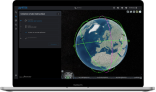
A UNIQUE DIGITAL PLATFORM TO OBSERVE THE EARTH

Space Sovereignty

as a service

A SOVEREIGN END-TO-END SOLUTION
Independently manage your own constellation, create your own services, control your sovereign data.

Roadmap

A spiraling innovation logic leading to sovereignty and real time

EOP application launch date, September 2022

White EOP logo
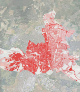
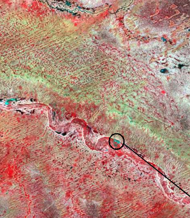
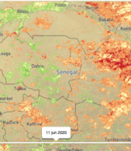
A unique platform to observe the earth

White EOP logo

A platform

unique for

observing the earth

EOP, an intuitive aggregative digital platform giving access to multi-source data archives and tasking, providing tools and services to enhance the value of data in the form of applications. A unique open and agile platform to manage all your geospatial projects.

ProtoMéthée launch date, November 2023

ProtoMéthée

Taking Prométhée Earth Intelligence into space

ProtoMéthée is based on Kongsberg NanoAvionics’ M16P platform, with Simera Sense’s MultiScape200 CIS multispectral observation instrument. Thanks to this instrument and the platform’s agility, ProtoMéthée will be able to provide around 44,000 km² of images of the Earth per day, with a resolution of 1.5 m.

ProtoMéthée, the first satellite to be put into orbit, heralds our future constellations capable of delivering data and services combining near-real time and hyper-reactivity.

HyperMéthée launch date, early 2024

HyperMéthée

Characterize matter from space

HyperMéthée will be Prométhée Earth Intelligence’s hyperspectral demonstrator. Hyperspectral technology allows us to understand what we see, to characterize space with precision. The Simera instrument chosen by Prométhée Earth Intelligence consists of a camera with 32 contiguous bands selected over a spectrum from 442nm to 884nm, with a high ground resolution of <5m.

With the choice of a hyperspectral satellite, Prométhée Earth Intelligence redefines the use of satellite data by offering a unique Hyperspectral Multispectral combination.

The Japetus constellation

Hyper-reactivity, real time and global coverage

CNES and the French Ministry of Economy, Finance and Recovery are participating in the financing of the dual demonstrator of the JAPETUS constellation within the framework of the France Relance recovery plan and by the European Union within the framework of NextGenerationEU.

The deployment of the 20 satellites of the future Japetus constellation will begin in 2025. The areas to be observed will thus be able to be overflown every 2 hours on average and up to every 45 minutes, an improvement of a factor of 10 compared to traditional space systems.

Combined with on-board AI capabilities integrated into the digital data processing platform, Japetus will enable automatic observation of sites, borders and large areas up to several dozen times a day.

Our advantages Seeing is knowing, knowing is acting

Global coverage

Synoptic view of large territories, discretion of observations

Cost reductions

Drastically reduce costs of access to Earth observation

Exceptional revisit rates

Access to data at an unparalleled frequency and accessible at all times

Unique database

Combination of spatial imagery and IoT data

Simplified access

A Saas offering with an optimized user experience

Services & Apps

Automated procedures and software development kits

Our Agenda

05

October

BIG – BPI France

17-18

October

They have supported us from the beginning